Bihar-Patna: Landowners need not worry about record updates; during the land survey, they just need to do this:
There’s no need for landowners to worry about land records and updates. If a land receipt isn’t updated, an old receipt is still valid. Even if the land mutation (record update) hasn’t happened, it won’t make a difference.

The Bihar government is conducting a land survey across the state. Landowners are mostly concerned about the records. Many say their land is still in their ancestors’ names. Some have land registry documents, but the land is still in the old owner’s name. The revenue department says there’s no need to worry about these records. Old receipts are acceptable, and it doesn’t matter if the mutation hasn’t been completed.
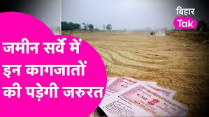
Supporting document for Land survey
To claim ancestral land, a family tree will be required. Survey personnel will ask for supporting documents only if there is an error or omission in the main documents presented. If there are no documents related to the land, you will need to gather the paperwork before the survey. Within the next 30 days, the land map will be determined in phases, the village boundary will be verified, and the map will be updated by the aerial survey agency. All accounts will be verified, and each plot will be numbered, with a separate plot map for each landowner.

The department has also released the website address for downloading online applications and necessary documents. Forms related to family trees and land surveys can be downloaded from the revenue department’s website, land.bihar.gov.in. If someone lives elsewhere, they can also apply online at landsurvey.bihar.gov.in or dlrs.bihar.gov.in. All information can be filled out online. The survey status and updates related to your plot can be checked on the survey tracking app.
Timeline for the survey
Survey work is ongoing in 45,000 villages in Bihar, with a set timeline for completion. The land survey process, conducted by the Revenue and Land Reforms Department, is expected to be completed within 360 days. A timeline has been established for all procedures. There will be two periods of 15 days each for the public to submit claims and objections. After completing all these procedures in phases, the results will be published. The goal is to publish the results of the land survey for all villages within about a year.
Validation with Government Records
The landowner or landholder will need to provide any proof or documents for their land, which will be matched with government records. Only after this verification will the documents be finally uploaded. If there is any discrepancy between the submitted documents and the government records—such as discrepancies in names, plot numbers, account numbers, or other details—the documents will not be uploaded. The concerned individual will be informed to submit the correct documents for their land. If they fail to do so, the existing name will be retained.

Documents are required for land ownership
During the land survey, the concerned individual will need to provide any documentary evidence related to their land to prove ownership. This can include documents such as the land’s khatiyan, receipts, records of entry and exit, or other government documents related to land ownership. Generally, there are three types of evidence based on the nature of the land: ancestral land khatiyan, deed or registry documents for purchased land, and a government-issued patta or bazagat patta if the land was allocated by the government.
Please like and follow my news channel to stay updated on the current news.
Facebook Page: https://www.facebook.com/360taazanews/
One thought on “Bihar Land Survey (बिहार भूमि सर्वे)”